
-
 Scattered to numerous snow showers will continue into the afternoon. Any additional snow accumulation will be less than an inch.
 -
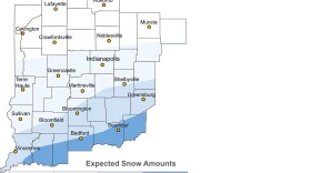 Up to 3 inches of snow with some ice mixed in is expected for portions of central Indiana Wednesday afternoon
 -
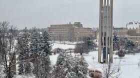
Snowfall totals should be under half inch, causing some slick areas on roads.
-
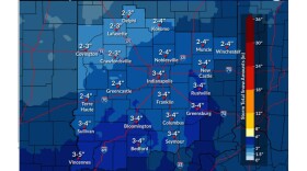 Forecasters at the National Weather Service in Indianapolis say higher amounts of snow will fall south and east of Indianapolis.
 -
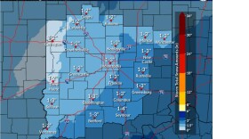 Another round of snow is possible Friday in most of central and southern Indiana.
 -
 The airport has over 50 pieces of equipment to help keep roadways and tarmacs clear.
 -
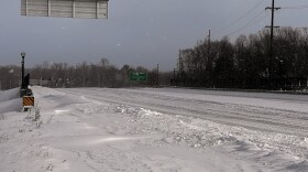
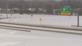 Crews have been clearing interstates and roads for travel, but conditions are still less than ideal.
 -
 “It is really, incredibly hard to be outside, even if there are shelters available. So, we are concerned and continue to do outreach to those who are unhoused in our community,” Bloomington Mayor Kerry Thomson said.
 -
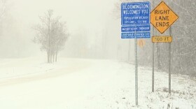 Justin Baker, deputy director of Monroe County Emergency Management, said the best way to weather the storm is to stay home.
 -
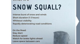 Squalls are intense bursts of snow that could lead to whiteout visibility and hazardous road conditions.

© 2026. The Trustees of Indiana University
Copyright Complaints
1229 East Seventh Street, Bloomington, Indiana 47405
Copyright Complaints
1229 East Seventh Street, Bloomington, Indiana 47405
News, Arts and Culture from WFIU Public Radio and WTIU Public Television
Play Live Radio
Next Up:
0:00
0:00
Available On Air Stations


